Key Takeaways
- What this is: A summary of the report "Black Geographies of New Haven," which traces the Dixwell Avenue and Winchester corridor through migration, redlining, industrial work, contamination, and today's redevelopment.
- Why it matters now: The former Dixwell Plaza and Winchester site are being redeveloped, and the report asks a spatial-justice question: who can remain, buy, work, and benefit as the neighborhood changes.
- Grounding: Every figure here comes from the report itself. Where the report is cautious, this piece is too, especially on the environmental findings.
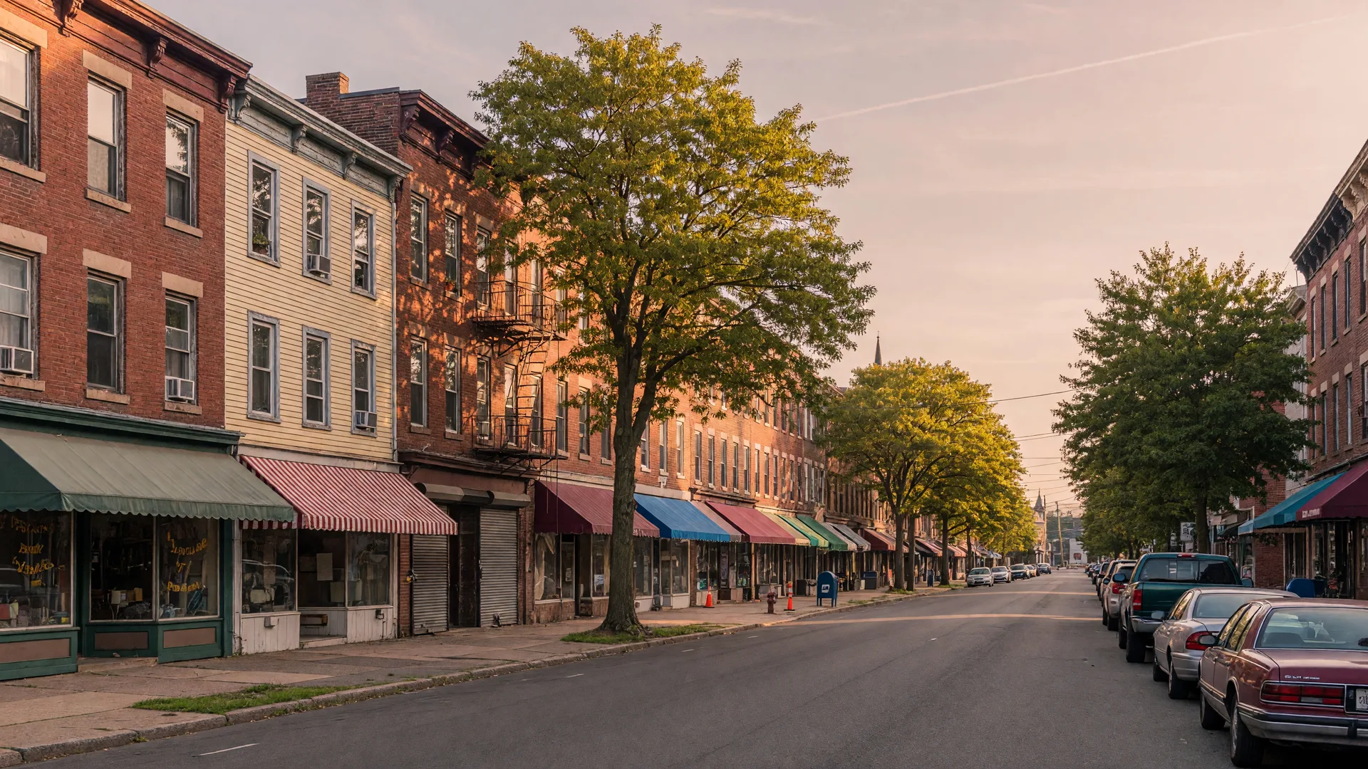
New Haven's Black history is written along the Dixwell Avenue and Winchester corridor. It is a story of migration and hard work, of families who left the rural South for industrial jobs and built a neighborhood with its own institutions, churches, and civic life. It is also a story of exclusion, redlining, and environmental burden, and of the choices being made again today as large redevelopment projects reshape Dixwell and the former Winchester site.
The report "Black Geographies of New Haven: Spatial Justice, Migration, Ecology, and the Dixwell–Winchester Corridor" pulls these threads together. For residents, it is a reminder that the corridor's future is not yet written: new investment is neither inherently harmful nor automatically just. The outcome depends on who can remain, buy, work, and benefit.
The Corridor in Brief: A Timeline
Key milestones along the Dixwell–Winchester corridor, from the report's own chronology: from the founding of the Dixwell church tradition in 1820 to the redevelopment wave of 2024–2026.
- 1820 African Ecclesiastical Society founded; the root of the Dixwell church tradition.
- 1850s–1870s Winchester industrial growth; worker housing expands near the factory.
- 1912 Harsh piecework and anti-union conditions documented.
- 1914–1917 Winchester's wartime workforce rises toward 17,000.
- 1920s Stetson's predecessor and the Q House anchor community life.
- 1937 HOLC residential-security map codifies a racialized investment geography.
- 1940s Wartime recruitment opens more industrial jobs to Black Southerners.
- 1956 IAM Local 609 organizes Winchester.
- 1960s Black population surges; urban renewal reshapes central New Haven and Dixwell; the Freddy Fixer movement emerges.
- 1969 103-day Winchester strike.
- 1979–1980 Six-month strike; policing and picket restrictions become central.
- 1990s High Performance Work Organization experiment.
- 2003–2006 Q House closes; New Haven gun production ends.
- 2021 Q House reopens; the state evaluates severe Winchester building contamination.
- 2024–2026 First Haven and Science Park redevelopment accelerate.
Migration and a "Proximity Paradox"
Black New Haveners settled close to the city's major industrial employers, most notably the Winchester Repeating Arms factory, while being largely shut out of the better jobs those plants offered. The report calls this a "proximity paradox": workers lived near the work, yet the work itself was often closed to them.
A study from around 1930 found most Black residents living "uptown" around Dixwell, and 52% of Black workers employed in domestic and personal service. Before World War II, migrants came mainly from coastal Virginia and North Carolina, with smaller streams from Georgia and the Caribbean. By 1965, nearly three-quarters of the city's Black household heads were Southern-born, and by 1970 African Americans made up roughly 35% of New Haven's population, nearly ten times their 1930 share.
The pre-war migration was both regional and diasporic. Southern migrants came disproportionately from coastal Virginia and North Carolina, with North Carolinians strongly linked to the roughly 100-mile coastal zone between Edenton and Beaufort, including New Bern; a smaller stream originated in Georgia. Caribbean migrants included people from Nevis, St. Kitts, Barbados, and Jamaica. In 1930, approximately 60 percent of New Haven's Black residents were Northern-born, about 30 percent Southern-born, and about 8 percent West Indian. Kinship and friendship generated chain migration: people wrote, visited, and followed relatives into particular northern cities, and those networks kept the stream flowing. The push factors were unmistakable: Jim Crow, racial violence, and precarious tenant agriculture; the pull factors were industrial wages, wartime recruitment, family connections, schools, and the prospect of greater, though far from complete, personal freedom.
Redlining and the 1937 HOLC Map
The 1937 Home Owners' Loan Corporation (HOLC) map used explicitly racial criteria to grade New Haven's neighborhoods. The older section around Dixwell received the lowest "hazardous" grade, while the adjacent area near Winchester, occupied mainly by skilled mechanics with no Black residents recorded, received a higher grade.
The report is careful to note that HOLC was not the sole cause of mortgage discrimination. But the map is a vivid document of how racial thinking shaped where credit flowed and where it did not, with consequences that echo in today's ownership numbers.
The Winchester Years: Work, Unions, and Strikes
The Winchester Repeating Arms factory was the economic engine of the corridor. Employment expanded from roughly 5,000 to 17,000 workers between 1914 and 1917, drawing thousands of new residents to the neighborhood.
The scale had been building for decades: by 1895 the plant already employed approximately 1,500 people in some 400,000 square feet of factory space, before wartime orders from Britain, Belgium, and France during World War I transformed its size. A 1912 labor account among roughly 5,900 to 6,400 workers documented a ten-hour day, straight-time overtime, strict lateness penalties, intense piecework, periodic piece-rate cuts, and surveillance and dismissal of suspected union supporters. Piece-rate systems shifted production risk onto workers, and Winchester remained exceptionally resistant to unionization for decades.
Unionization came in 1956 with IAM Local 609. Arthur Bosley, its first African American president, recalled that the union's seniority and bidding rules opened a wider range of jobs to Black workers. Major strikes in 1969, lasting 103 days, and in 1979–80, lasting six months, drew community-wide mobilization in support of the workers.
The mechanism behind the union's effect mattered: formal seniority and bidding rules could partially replace foreman discretion, opening civil-rights access through shop-floor institutions rather than solely through outside law. The 1979–80 strike, a six-month struggle over production standards, also made the link between labor geography and policing visible: a court injunction constrained the number and conduct of picketers, police registered or monitored picketers, police escorted people entering the plant, several strikers were arrested, and a much larger regional labor mobilization eventually marched in support of the workers. The settlement raised pay, pensions, and medical benefits but gave management substantially greater leverage to establish production standards.
Workers like Lawrence Young, hired in 1943, remembered higher pay and greater freedom in Connecticut than in the rural South, but also that Black workers had to outperform white colleagues to earn equal recognition. The factory was a place of opportunity and of persistent inequality at the same time.
Young's own story shows what that looked like. Born in Arkansas and trained through a segregated wartime vocational system, he was transferred to Connecticut and hired at Winchester in 1943; he remembered being among the first Black workers in its woodworking department, with a cousin beside him. White skilled workers resisted training them, and most African American employees remained concentrated in cleaning, machine maintenance, and other dirty, low-paying jobs. His woodworking skill put him in an unusually well-paid position: he remembered earning 60 cents an hour in 1943, vastly more than the rural Arkansas wages available to him earlier.
One caution about the closing date: different sources describe different stages of contraction. Some accounts use 1981 for the cessation of operations across much of the historic Winchester complex; Connecticut public-health documentation describes rifle manufacturing at 275 Winchester Avenue from the 1870s through 2006; and Local 609 histories follow successor gun production to the 2006 closing. The report concludes it is more accurate to speak of a multi-stage contraction and partial reuse than of a single instantaneous plant closure.
What the Environmental Findings Show
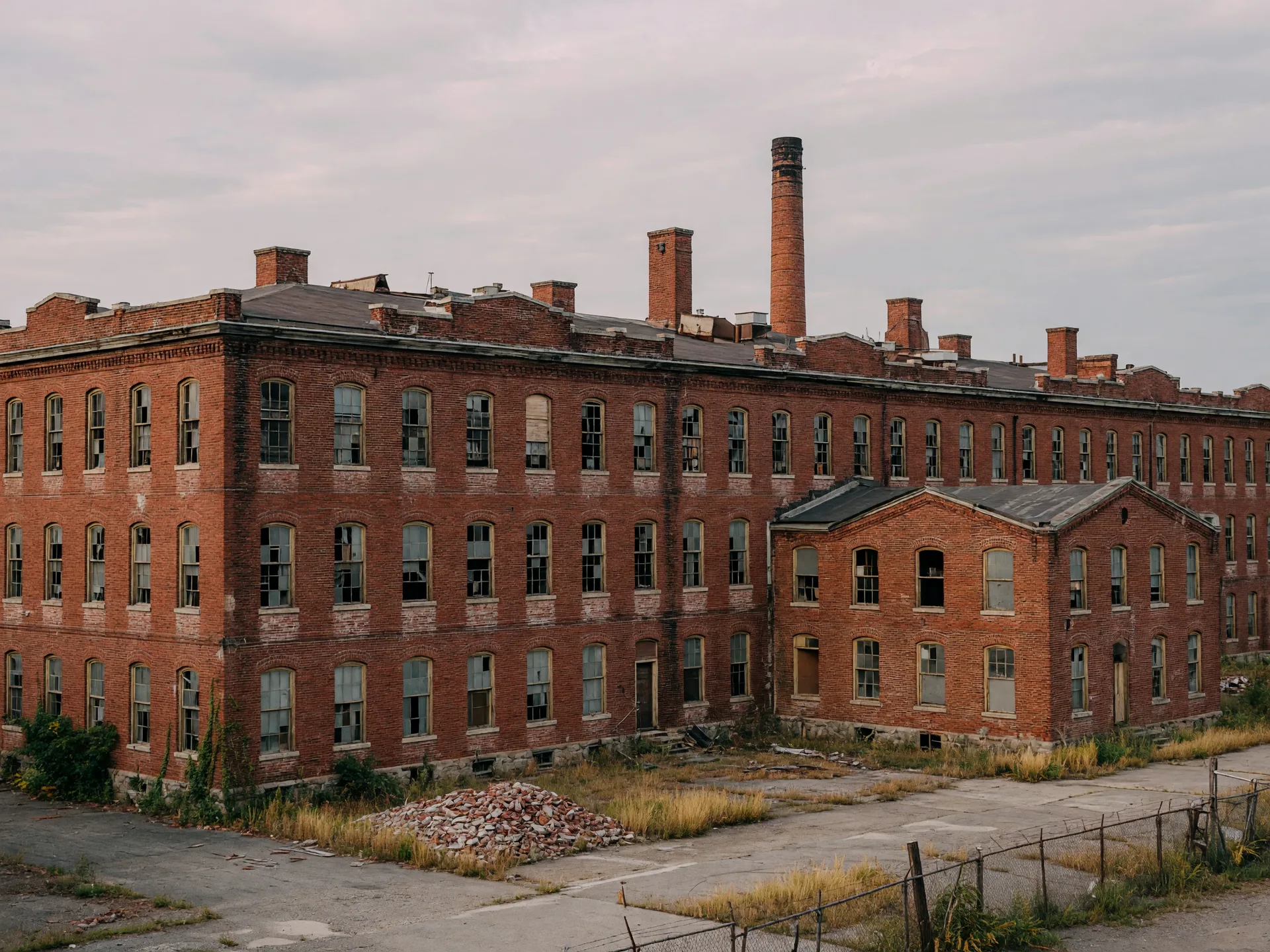
The former Winchester property is a heavily contaminated 75-acre arms-manufacturing site where heavy manufacturing involved metalworking, woodworking, drilling, milling, and extensive use of oils and solvents. In four surviving Tract A buildings, contaminants had penetrated concrete floors, walls, and structural columns. A 2020 bench test measured trichloroethylene (TCE) at 110 micrograms per cubic meter, 110 times the 1 microgram per cubic meter target used in the analysis, methylene chloride at 660 and 920 micrograms per cubic meter, and elevated petroleum-hydrocarbon fractions. In February 2021, the Connecticut Department of Public Health concluded that off-gassing could pose unacceptable exposure for future occupancy and that it could not conclude that future human occupation of those buildings would be safe.
The report is careful about what these findings mean. This was a bench-scale test of contaminated concrete in one building, the findings concern the contaminated buildings and potential future indoor exposure, and they are not evidence that surrounding residents received those doses. The report stresses this should not be transformed into an unsupported claim of neighborhood-wide exposure or disease. Separately, in its 2024 review of Science Park Tract A, Connecticut DEEP noted that the site drains toward New Haven Harbor, which is impaired for aquatic life, recreation, and shellfishing, and recommended careful sediment and stormwater management as well as green infrastructure capable of capturing and infiltrating runoff. That is why DEEP emphasized stormwater controls and green infrastructure in the redevelopment design.
Community Institutions That Built the Corridor
The corridor's strength was never just the factory. It was the institutions residents built. The Q House, the Dixwell Community House, served generations before closing in 2003 and reopening in 2021. Stetson Library anchored learning. Dixwell Avenue Congregational Church traces its roots to the African Ecclesiastical Society, founded in 1820. The Elks at 204 Goffe Street offered gathering and fraternal space.
The Q House grew out of Dixwell Congregational Church youth programs. Planning and interracial fundraising began in 1924–25, and the institution operated from 98 Dixwell Avenue, providing educational and recreational activities to as many as 400 young people and even sponsoring an annual Negro Health Week. It closed in 2003 and reopened in a new form in 2021, an unusually long life for the idea that Dixwell requires community-controlled social infrastructure.
Stetson Library's timeline reaches back to the factory itself, an industrial-community connection often overlooked in Winchester histories. In 1917 Winchester made space available at 213 Division Street for a Dixwell branch library. A Carnegie-funded branch opened on Dixwell Avenue in 1922, was renamed for Willis K. Stetson in 1941, and moved to 200 Dixwell Avenue in 1969. The library's trajectory ties together factory paternalism, Black access to knowledge institutions, and the physical restructuring of the corridor.
Fraternal and recreational organizations added another layer. Prince Hall Masons acquired the former Goffe Street School, and the Black YMCA lineage grew out of the Olympian Athletic Club. The YMCA story is especially revealing: Black members affiliated with the central YMCA but withdrew for a period when barred from its downtown pool and gymnasium. Separate Black institutions were thus not simply signs of voluntary cultural difference; some were adaptive responses to exclusion from nominally civic space.
And the Freddy Fixer movement adds an ecological dimension to that history. New Haven Free Public Library's local history traces the movement to 1962, when residents organized a neighborhood cleanup in response to inadequate attention to neighborhood conditions. The initiative expanded into the Freddy Fixer Parade in 1963 and became one of New England's major Black cultural events, a celebration that still draws the city together each spring. Environmental justice here was not originally articulated through contemporary pollution language; it appeared as collective maintenance, cleanliness, pride, and a claim on municipal attention.
The Spatial-Justice Picture Today
The report's numbers for Dixwell tell a stark story against the city as a whole. In 2017, Dixwell's homeownership rate was only 15%, and 85% of occupied units were rentals. Fully 55% of residents lived below 200% of the poverty level, and 61% of renters were housing-cost-burdened, meaning they spent a large share of their income on housing.
The modern population figures show a long decline and a modest rebound. Under the report's reconstructed modern Dixwell neighborhood boundary, the count was 6,298 residents in 1990, 5,011 in 2000 (3,600 Black, about 71.8 percent), 4,902 in 2010, near the modern-series low, and 5,006 in 2017, when 3,216 residents were Black, about 64.2 percent, and white and Latino shares had increased. The 2017 housing detail is worth sitting with: 2,088 units, 262 vacant and 1,826 occupied, with just 278 owner-occupied homes versus 1,548 renter-occupied, that is 15 percent owner-occupied and 85 percent renter-occupied, and average household income of $42,091. Most households do not automatically receive the household-wealth benefit that rising real-estate values can bring to owners.
One caution applies to every number in that sequence: these are map snapshots from different eras, not one continuous statistical series. The 1940 and 1960 figures are federal Census tracts; the 2000 and 2017 figures are assembled to modern City Plan/DataHaven neighborhood boundaries; the 1960 income figure concerns families while the 2017 figure concerns households; and the dollars are nominal amounts from different eras. They should not be plotted as a literal real-income time series.
Citywide, the report cites a median household income around $53,771, a homeownership rate of 28%, a poverty rate of 25%, and 49% of renters housing-cost-burdened. The gap between Dixwell and the rest of New Haven is the spatial-justice question at the heart of the report.
The Redevelopment Moment
Two big projects are reshaping the corridor. ConnCAT's roughly 65,000-square-foot headquarters is set to open in June 2026 as the first major component of an approximately $200 million, eight-acre redevelopment of the former Dixwell Plaza. Plans include housing, grocery and food uses, retail, workforce training, and performing arts. A planned 184-unit residential phase would include 37 income-restricted apartments, about 20%, targeted at 60% and 80% of area median income. The report notes that residents at public discussions argued the affordable share was insufficient.
The project is explicitly framed by its sponsors as a revival of Dixwell's historic Black commercial corridor. And the city is not leaving all redevelopment to speculative acquisition: municipal property-acquisition discussions explicitly describe certain Dixwell Avenue parcels as critical to corridor revitalization and emphasize the desire to secure community benefit and prevent blight or purely speculative control.
At the former Winchester and Science Park site, The Winston is a $92.5 million initial development phase: 283 apartments, approximately 12,800 square feet of retail, and 57 affordable apartments, about 20% of the total, targeted on average around 50% of area median income. Announced market-rate rents range from roughly $1,850 to $4,250 depending on unit. Whether these projects deepen or ease the corridor's housing pressures depends on the details, and on the community's voice in them.
Environmental repair is part of the redevelopment bargain. DEEP subsequently emphasized stormwater controls and green infrastructure in redevelopment because the site drains through New Haven Harbor, an impaired water body. The environmental-justice benchmark should include not only whether contaminated buildings are removed but whether redevelopment produces safer soil and buildings, lower runoff burdens, trees, and usable green space for surrounding residents.
Looking Forward: A Spatial-Justice Test for the Next Decade
The report frames the next decade as a spatial-justice test. What happens with housing retention, resident ownership, employment access, Black-owned business continuity, environmental repair, and public-space governance? And who captures the land-value appreciation that new investment brings?
Seven Questions to Watch Over the Next Decade
The report's spatial-justice test, in plain language. The answers, not the dollar signs, will show whether the corridor's new chapter is just.
- Housing retention: can residents stay? Watch eviction filings, rent change, subsidized-unit duration, and tenant relocation and return rates.
- Resident ownership: can residents own? Watch home-purchase rates, community land-trust units, co-op ownership, and the Black homeowner share.
- Employment access: do residents get the work? Watch construction hiring, permanent jobs by occupation and wage, apprenticeships, and local-resident hiring.
- Commercial continuity: do Black-owned businesses stay on the avenue? Watch Black-owned business tenancy, rent concessions, and ownership of storefront real estate.
- Environmental repair: is the land actually repaired? Watch remediation completion, vapor and soil monitoring, tree canopy, stormwater infiltration, and park access.
- Public-space control: who runs the new public spaces? Watch who sets rules for plazas, programming, and security, and whether the spaces remain practically accessible.
- Value capture: who benefits when values rise? Watch assessment increases, property sales, tax abatements and subsidies, and the distribution of public investment.
New investment is neither inherently harmful nor automatically just: grocery access, environmental remediation, jobs, housing, arts space, and restored public activity can constitute real spatial repair. But given existing rental dependence and cost burdens, the central distributional questions are who can remain, who can buy, who receives contracts and jobs, whose businesses occupy storefronts, and who captures appreciation created partly through public remediation and planning. The outcome depends on who can remain, buy, work, and benefit. For New Haven residents, the Dixwell–Winchester corridor is not just a place with a past. It is a place whose future is being decided now, and the report is an invitation to watch, and to weigh in, with the full story in view.
Frequently Asked Questions About Black Geographies of New Haven
- What is “Black Geographies of New Haven”?
- It is a report that traces New Haven's Black history along the Dixwell Avenue and Winchester corridor, from migration and industrial work to redlining, community institutions, environmental contamination, and the redevelopment reshaping the area today. It frames the corridor as a case study in spatial justice, asking who gets to remain, buy, work, and benefit as the neighborhood changes.
- Where is the Dixwell–Winchester corridor?
- It runs along Dixwell Avenue in the northern part of New Haven, near the site of the former Winchester Repeating Arms factory, sometimes called the Science Park area. For generations this corridor was the heart of Black New Haven, where families settled close to industrial jobs and built institutions like the Q House, Stetson Library, and Dixwell Avenue Congregational Church.
- What is happening with the redevelopment of the former Dixwell Plaza and Winchester site?
- ConnCAT's roughly 65,000-square-foot headquarters is set to open in June 2026 as the first major piece of an approximately $200 million, eight-acre redevelopment of the former Dixwell Plaza, with housing, grocery and food uses, retail, workforce training, and performing arts planned. At the former Winchester site, The Winston is a $92.5 million initial phase adding 283 apartments and about 12,800 square feet of retail, including 57 income-restricted apartments.
- Is the old Winchester site contaminated?
- Yes. The former Winchester property is a heavily contaminated 75-acre site. In four surviving buildings, testing measured trichloroethylene (TCE) at 110 micrograms per cubic meter in a 2020 bench test, compared with a 1 microgram per cubic meter target used in the analysis, and methylene chloride at 660 to 920 micrograms per cubic meter. Connecticut's Department of Public Health concluded in February 2021 that off-gassing could pose unacceptable exposure for future indoor occupancy. The report stresses these findings concern the contaminated buildings and future indoor use, not evidence that surrounding residents received those doses.
- What is the Q House?
- The Q House is the Dixwell Community House, a beloved neighborhood institution that served generations of Black New Haveners with recreation, education, and community programs. It closed in 2003 and reopened in 2021, and its revival is seen as a symbol of the corridor's resilience and a centerpiece of its future.

About Robert Clarke
Real Estate Professional · Coldwell Banker Realty · License #0815837
Robert Clarke is a licensed Connecticut real estate agent with 30 years of experience helping families buy and sell homes across New Haven, Hartford, Bridgeport, Stamford, and surrounding areas. A Coldwell Banker Realty agent and probate specialist, Robert combines deep local knowledge with a tech-driven approach to make every transaction seamless. Contact Robert at (203) 936-9004 or visit his contact page.
You Might Also Like
Community
Black Wall Street Festival 2026
A week-long celebration of Black and Brown-owned businesses, artists, and culture on the New Haven Green.
Heritage
Remembering Clarke's House & Window Cleaning Service
How one family's business kept New Haven shining for generations, and the story behind The Clarke Archive project.
Local Life
Why New Haven Is Connecticut's Best Kept Secret
From world-class pizza to Yale's free art gallery, why this small city keeps earning big-city recognition.
Robert Clarke
Real Estate Professional · Coldwell Banker Realty
Robert is a Connecticut real estate professional with 30 years of experience and a deep passion for the New Haven community. Learn more about Robert →